adventures with gumby and reba

Quest for NE 67 and other hikes


Leave a comment

Mt Cardigan

This is the last entry in my blog.  I had hoped to hike the last 3 4000 footers by the end of this semester but that did not happen.  I still plan on finishing them before the end of the summer and have Reba finish hers (she has 5 more to go) by the end of the summer too.

Last Saturday I hiked Mt Cardigan with Beth, Lindsey, Cooper, Benson, Jen and her greyhound Genie.  I have hiked this mountain countless times, but it is a great hike and very close to my house! On the way up to the trailhead I saw a moose hanging out on the side of the road which was great to see!  But couldn’t stay long the dogs started to bark and go crazy…


We started at 6:30 am since it was supposed to rain at some point that morning.  Loved having the trail to ourselves!  Usually Cardigan is a busy trail.  We went up and across Firescrew to get to the summit.  This route lets you enjoy open rock and great views.  We did encounter some snow and ice in the shaded areas but easy to get around it.


We had the summit to ourselves for the most part, only one other hiker passed by.  After a snack we headed back down on the Clark Trail.  The pups had a great early morning hike and so did we!


Leave a comment

Blueberry Mountain 52 with a View

Since I have been unable to get to hiking the 3 mountains left on my NH 48 list I have started to work on the 52 with a view hiking list.  The are shorter usually and I can bring Buck on most of them.  This past Wednesday I was joined by my friend Kathie and her dogs Bodhi and Jasper for a hike up Blueberry Mt in Glencliff NH.  I had never heard of Blueberry Mt and after seeing pictures of all the open rock face I was excited to hike it.

We decided to do a car spot so we could enjoy the whole trail from end to end.  We found that Long Pond Rd was closed due to it being washed out and trees down from storms.  This was ok since it was only a .7 mile walk to the trail head.

Since it was a mid week day we had the trail to ourselves which was amazing so we never had to worry about leashing the dogs.  They were so happy to just run freely, play in all the water, mud and sniff all the wild animal smells!

The trail to the summit was a very easy, gradual climb through old farm land, open woods and then to open rock slabs.  Along the way we kept seeing very fresh coyote scat, but never saw the coyote which was nice!  Once we hit the open rock we had a wonderful view of Mt Moosilauke.


Before arriving at the summit we did encounter some snow and ice but all easily passable.  We had a snack at the summit and enjoyed the beautiful weather and views.  When we started off again we became rather confused since the trail blazes where non-existent we thought we would just follow the cairns that were scattered around on the summit.  This did not lead us to a trail…Thank goodness we had cell service because the map did not show the spur trail and we were able to read a trail description from a website.  Once we figured out where to go things where good.


The hike down was very pretty, more open rock slabs and wonderful views of Black Mt, Sugarloaf Mt and many others.  As we came closer to the end of the trail small streams where more like rivers but still easy to cross.  The dogs really enjoyed taking a quick dip to cool off!  The hike in total was about 5 miles (forgot to turn on my Gaia GPS app).


Leave a comment

Welch and Dickey and Round Top

This week I was busy studying, its getting close to the end of the semester so not a lot of time to go hiking with the dogs.  But today I was able to get an early morning hike in at Welch and Dickey in Thornton.  I was joined by Reba, Beth, Jen, Lindsey, Cooper and Benson.  Buck stayed home to keep Emma company.

Welch and Dickey

It was misting and very foggy when we started out.  We made it to the top of Welch quickly since it is a very easy hike up to that summit.  WE enjoyed being the only people out on the mountain since the weather was not very nice and it was early.


We then headed over to Dickey.  This was a bit more challenging with wet rocks and the occasional ice/snow patches.  We took our time and had a few slip and falls but we made it over to Dickey.  Usually you can get a great view from both summits but not today.  The total distance was 4.38 miles and it took up 3.5 hours to do.  The best part was we didn’t see a sole until we where almost back to the parking lot!

Round Top

Since I did not take Emma and Buck on the hike I had to get them outside since the day turned out to be beautiful.  We picked up my dad and headed over the Round Top (Emma’s choice).  We enjoyed another nice hike with out running into anyone.  The dogs could be off leash and chase as many chipmunks and squirrels as they wanted.  We sat at the top for a while just enjoying the sun.  The pups also enjoyed hanging out together at the top.


Leave a comment

Mt Major

This week has been full of studying leaving little time for a big hike. The pups and I did a few small hikes around Bristol during the week and then today we hiked Mt Major with Lindsey, Cooper and Benson.


This was the first time up Mt Major for Buck and Benson.  The rest of us have done it a few times.  We out on a nice flat trail that was a little muddy.  Once we started to gain elevation we ran into some ice.  We all had our microspikes which made it much easier going up, but since it was ice combines with bare rock we had to take them off and put them on again a number of times.  Since we started rather early when we reached the top we had it mostly to ourselves.  Emma gave all the puppies treats and we had our photos taken then we started of to do Straightback Mt which is about a mile from Major.  The trail is a mix of bare rock and woods.  When going down some bare rocks Emma slipped and landed hard.  She was unsure if she wanted to continue, but she eventually decided to continue on.  We ran into more slippery terrain and Emma decided she had enough so we turned around and headed back.  Going back down took longer than excepted due to the mass amount of people hiking up the trail to Major.  It was a struggle for almost all of them trying to climb up the icy, slippery trail with just sneakers on.


We will head back to Straightback soon but we will not be headed up Major again for awhile, we try to avoid the popular trails so we can enjoy being out in the woods!


Leave a comment

Red Hill and Mt Monroe

This week Reba, Buck, Lindsey, Cooper and Benson climbed Red Hill in Moultonborough.  We have hiked this many times but it was Bucks first time.  It was a sunny morning and no snow on the ground.  Just some ice in spots.  It was nice not to have to worry about snowshoes, microspikes  and all the other things that go along with winter hiking!  This hike leads to a fire tower that provides great views of the surrounding lakes and mountains.  It is a short hike just 3 miles round trip, and also an easy hike so Lindsey and I had to the chance to chat and catch up.


On Wednesday I hiked Mt Monroe which is part of the Presidential Range.  I was accompanied by my uncle Bill, his friend Peter, Jen and her friend Betsy, Kathie and Bodhi and of course Reba.  The weather was forcasted to be partly cloudy and lows in the 30’s and breezy.  We started up the Ammonoosuc Ravine Trail and the weather was sunny, warm and no wind.  About an inch of new snow had fallen over night, but not enough to need snowshoes yet.  This trail starts off nice and gentle then it starts to get steeper and steeper.  We started to find that there was a lot of ice under the newly fallen snow and microspikes were almost not enough, crampons would have made it much easier.


Once we started to get above tree line the ice increased making even the smallest inclines hard to manage.  We had to make our own trail at some points just to avoid the ice.  At this point Kathie and Betsy decided they had had enough and turned back due to the ice and the clouds had moved in and snow showers had started.  The rest of us wanted to continue on to the Lake of the Clouds Hut and decide what to do from that point.  It was slow going on the ice but the snow stopped and still no wind.  Once we made it to the hut we had a snack and debated on if we should attempted Monroe or not.


When looking up from the hut at Monroe it looks like a quick hike to the top and should be no problem.  So we decided to give it a try, the Crawford Path had not been traveled so we had to break trail to the Monroe Trail.  It was a mix of ice and snow drifts but it was just a short distance.  We started up the Monroe Trail which was easy to follow at first, we could see the cairns the trail was exposed for the most part.  Then we came to a spot that left you an option to go right or left.  The snow had drifted quite a bit making finding a cairn impossible.  I tried to go right because it seemed like the way to go.  But the snow had drifted in such a way that as you walked the snow seemed like it was going to give out underneath you and send you sliding down back to the hut!  Not a comforting feeling I decided to turn around and Bill tried to go more to the left.  But that lead you to a spot that you would have to have crampons and an ice axe to get to the top.  At that point we decided to call it and head back down.  It was the right choice but so frustrating since you could literally see the summit and it was so close to us but unsafe to get too.

We had a good hike back down with lots of butt sledding since it was the easiest and safest way to get down what we had just climbed up!  Monroe is not going anywhere and I will make it to the summit next time!  Maybe when the snow and ice melt!!


Leave a comment

Bald Peak

This week was a slow week for hiking.  I had a lot of studying to do but we did get out for a few short walks locally.  On Easter we were joined by my sister, niece and their dog Milo for a small hike.


Thursday we did get a chance to go for a hike with my friend Kathie and her dog Bodhi and a friends dog Jasper.  We went to Bald Peak which is off t Kinsman Trail in the Franconia/Easton area.  The conditions where a variation of mud, snow and ice but not enough snow to need snowshoes.  The Kinsman Trail was very easy and a gradual climb.  There were only two steeper short ascents on this trail.  Bald Peak trail is off the Kinsman Trail.  In just .2 miles you open up onto a rocky ledge with great views.


Time was very limited for me so we took some pictures then headed back down.  The dogs all enjoyed chasing each other, chasing squirrels and chipmunks and Buck and Jasper enjoyed all the muddy puddles they could find!  The total hike was 4.28 miles and we did it in 2 hours.


Leave a comment

Owl’s Head

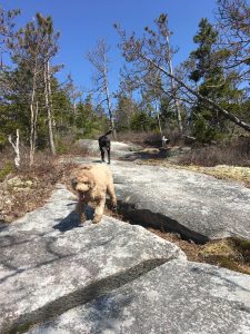
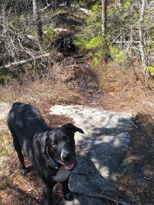
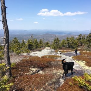
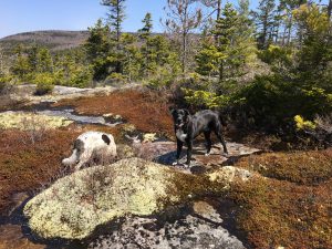
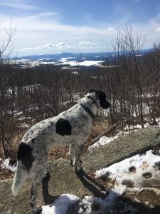
Reba and I received our first hiking patch this week, the Belknap Range Hiker patch!


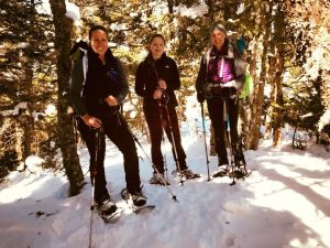
This past Sunday Beth, her daughter Madison and I climbed Owl’s Head which is a 4000 footer in the Lincoln area.  This is one of the mountains that is the most dreaded to climb due to the long distance of the hike, the relative flatness of most of the hike and the lack of a view for all the work it takes to get there.  In the winter months bushwhacks are created to help cut some of the distance off the hike and avoid the rock slide that you have to climb to get to the summit.

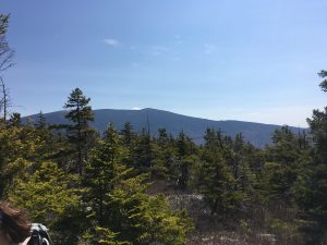
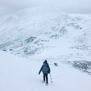
We mapped out our hike on our GPS app so we had a good idea where the bushwhacks where in case the trail had not been broken out yet.  Due to the distance I left Reba at home and will repeat it in the summer when we can do an overnight to break up the distance for her.  We started at 7:30 and followed the Lincoln Woods Trail for a few miles until we came to the Black Pond Trail.   Both trails are very flat so we where able to move along quickly.  Once we got to the pond we had our first glimpse of Owl’s Head.  It seems to shot straight up out of the woods.

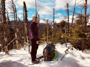
Looking up at Owls Head     Black Pond


The bushwhack had been packed out which was great but whoever cut the trail did not follow the original bushwhack trail so we did become a little concerned that we might be lead astray.  But we pushed on and used our GPS to help us out and we ended up where we needed to be on the Lincoln Brook Trail.  We followed this trail for a few more miles until we reached the next bushwhack, called the Brutus Bushwhack.  At this point we where rather tired and it was already noon.  We had decided on a 2 pm turn around time if we did not make it to the summit.  We had only seen one other group of people that where head back out so we where beginning to have doubts  about finishing.  But then another group of hikers came along and our doubts changed knowing we where not the only ones out that far in the wilderness.

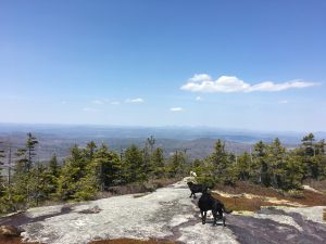
We began to climb up the bushwhack which was a very, very steep ascent up to the summit.  The snow was not packed down well and soft so the climbing was slow and exhausting.  It took an hour to make it to the top and we did get a few views of the Franconia Ridge and the Bonds which was nice.  Once you hit what you think is the top really is not the top.  You have to hike another quarter mile till you actually hit the real summit.


We where very excited to have made it to the summit, but then the thought of having to go down and back out was not very exciting.  we had some lunch and then started our descent down the steep slippery mountain.  Once back down we began the long trek back out to the parking lot on very flat trails.  By the time we made it to Black Pond it was 6 pm and the exhaustion was hitting us.  We finally made it back to the car at 7 pm and before dark set in.  The total hike was about 17 miles.


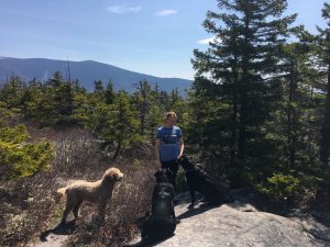
This hike was by far the most mentally challenging hike I have ever done.  Knowing that I will not be doing it again in one day is a comforting feeling, but it is nice to know that I can hike 17 miles in one day! Only 3 more 4000 footers until I am done with all 48.  Then on to hiking the 4000 footers in ME and VT to complete the 67.


Leave a comment

Mt Sunapee

This week I did an annual hike with my dad and Uncle Bill.  Both are my Uncle Tim’s brothers.  This year they wanted to hike Mt Sunapee.  None of us have ever hiked this mountain, but the trail descriptions sounded like it was not very hard and only 5.4 miles.  It was a cold windy day, but the sun was out and not a cloud in the sky.


We started out on a packed trail that lead us to the top of the Sunapee ski area.  It offered a great view of the White Mountains.  We had to follow the ski trail to the next trail.  We found that this trail was not packed out so I took the lead and packed the trail out.  This trail went on for over a mile.  We got to a nice look out of Isolation Lake, the trail leading from this point was well traveled so it made the going much easier.


Until we reached a point in the trail that was supposed to have a fork in it, but there wasn’t a fork.  The GPS app I use, the map we printed out and the AMC map I have all had the fork indicated on it, but it wasn’t there.  Having left a car at the trail head we where trying to get to we decided to bushwack to try to find the trail.  This added a few extra hours on to the hike and another mile.  We did finally find the trail and our car.  It was an interesting hike and great to be out there with my dad and uncle!


Leave a comment

Piper Mt and Mount Tecumseh

After the what felt like never ending snowfall Lindsey and I and of course all the dogs hiked Piper Mt in the Belknap Range in Gilford.  Someone had already broken the trail out which was great.  I have hiked Piper a few times in the past and have completed the Belknap Range.   It is a nice hike that leads to an open rocky top with good views.  To get to the top of Piper you have to park on Carriage Rd and walk to the trail head during off season.  The trail you take to the top is Piper Mtn Trail, round trip it is about 3 miles.  The trail climbs slowly with a few steep pitches.  The snow was very deep off trail and Reba thought it was great to chase after squirrels into the deep snow.  Benson the Bassett Hound attempted to follow but quickly realized it was not a good idea since he was sinking up to his ears in the snow.  The top of Piper was rather windy and we had it all to ourselves.  There are many cairns at the top but not many visible with all the drifted snow, but the rock chair was snow free.  To get to real top of Piper you have to hike a little further till you get to a large cairn that marks the highest point of the mountain.  It was another great hike and more amazing pictures from Lindsey!

On Sunday I had originally planned to hike Owl’s Head which is a 4000 footer that I need to complete the list.  But scheduling problems with the others in the hiking group and weather made us change our plans.  So Beth and I choose to hike Mount Tecumseh in Waterville Valley.  It is a 4000 footer that we have both hiked during the summer but hadn’t hiked it in the winter.  It was cold so I did not bring Reba with me on this hike.  The trail we took was the Mt Tecumseh Trail which starts in the parking lot of the ski area.  The trail was still soft from all the snow and the snow that was falling on us so we used snowshoes the whole hike.  It is a short hike but a steep hike up to the top.  This trail is also popular with backcountry skiers who skin up it and ski down the ski trails and we ran into a few along the way.  The total mileage for the hike is around 5 miles and it took us 2.5 hours to complete it.  It was much faster to hike in the winter since the snow covered up the long stretch of stone stairs that are found on this trail.  No few at the top this time but it was Gumby’s first time up!


Leave a comment

Arethusa Falls and Rattlesnake

This past weekend my daughter Emma, Lindsey and the dogs went for a short hike to Arethusa Falls in Crawford Notch.  The hike was short maybe about 2.5 miles round trip and relatively flat.  It is a very busy trail and even with us starting later in the afternoon on a Sunday the trail was still busy.  Buck and Reba had a lot of leash time on this hike, which they where not to happy about but it’s good to remind them about leash manners.  When we got to the falls we had it all to ourselves so we spent time taking pictures and just admiring the beauty of the falls.  It was much larger than I imagined and Lindsey took some more amazing photos!


On Wednesday before the big snow storm I went for hike up Rattlesnake in Rumney NH with my friend Jen.  Reba and Buck were the only dogs on this hike and we did not see another person on the trail!  The trail up to the top is easy and takes less than an hour to get to the top.  At the top it is a open rock that provide nice views.  It slipped my mind to take pictures of Gumby on my last few hikes, but he was with me in the backpack!